
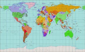
Projection map: Is a systematic transformation of the latitudes and
longitudes of locations on the surface of
a sphere or an ellipsoid into locations on a plane.
Map projections are necessary for creating maps. All map projections distort the surface in some
fashion. Depending on the purpose of the map, some distortions are acceptable
and others are not; therefore different map projections exist in order to
preserve some properties of the sphere-like body at the expense of other
properties. There is no limit to the number of possible map projections.
Distortion: is the alteration of the original shape (or other
characteristic) of something, such as an object, image, sound or waveform.
Distortion is usually unwanted, and so engineers strive to eliminate
distortion, or minimize it. In some situations, however, distortion may be
desirable.
.png&container=blogger&gadget=a&rewriteMime=image%2F*)
Treasure Hunt: is a minor activity in relation to the WebQuest.
In this
activity, students should not carry out a complex task, you only need to find
answers to some questions given in the content of the links previously selected
by the teacher. Sometimes included a global question that requires the student
to make a more elaborate use of the information, this is called "the big
question".
Treasure Hunt may consist of the following
elements:
- A
Brief Introduction on the subject which may include an explanation of the task that
the student will perform.
- A set of more or less difficult questions, depending
on the level and age of the students.
- The "big
question" that must be answered after thinking about all the information obtained.
- Links to web pages where students will find the answers.
-
An assessment
section where you explain how you are going to rate the task performed.

The Earth
Ecuador, is the plane perpendicular to the axis of rotation of a planet
and passing through its center.
-
Divide
the planet's surface into two parts, the northern
hemisphere and the southern
hemisphere.
-
The
latitude of Ecuador is 0 °.
-
The
plane of Ecuador "short" the planet's surface on an imaginary line (great
circle) which is exactly the same distance from the geographic poles (line equidistant
from the North Pole Ecuador and the geographical South Pole).
-
The
equatorial circle of the Earth is about 40,075 km. Its radius is 6371 km.
.png&container=blogger&gadget=a&rewriteMime=image%2F*)
The media
are diversified media technologies
that are intended to reach a large audience by mass communication.
The technology through which this communication
takes place varies.
-
Broadcast
media such as radio,
recorded music, film
and television
transmit their information electronically.
- Outdoor
media -commercial buildings, sports stadiums, shops and buses, blimps, and skywriting.
- Public
speaking and event organizing can also be considered as forms of mass media.
- The digital
media comprises both Internet and mobile
mass communication.
- The
organizations that control these technologies, such as television stations or
publishing companies, are also known as the mass media.
.png&container=blogger&gadget=a&rewriteMime=image%2F*)
.png)
.png)
.png)
No hay comentarios:
Publicar un comentario